
Zeitungsreise: Living History

Topic

Topography

4 articles

Articles

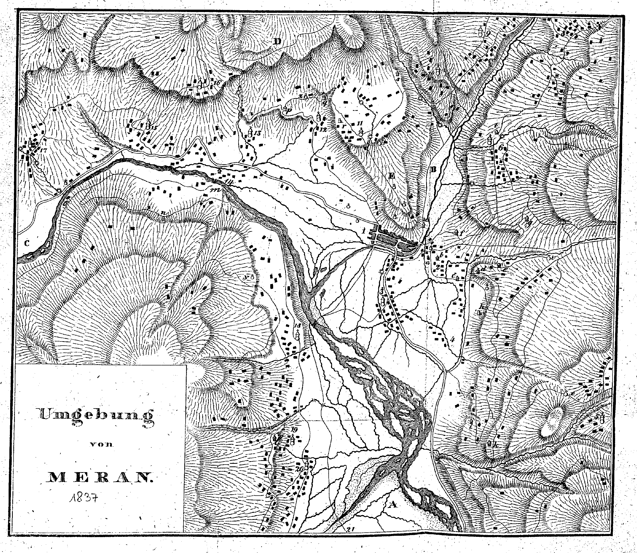
Map of the Surroundings 1837

This historical map by Dr. Johann Nepomuk Huber shows the surroundings of Merano in the year 1837. Recorded in detail on the map are the topographical features of the Burggrafenamt, the course of the rivers (Passer/Etsch), as well as surrounding localities and farmsteads, marked with letters (A, B, C, D, E) and numbers. See > Explanation of signs and numbers

1830s4 tags
Der Bote für Tirol1819–18295 tags

Topography: Description of the Surroundings of Merano (Tyrol Castle)

This 1822 excerpt describes the location, architecture, and eventful history of Tyrol Castle. Following its plundering and threatened demolition in 1808, the castle was repurchased in 1814 by the city of Meran, restored to the Emperor, and renovated. Additionally, the panoramic view over the Burggrafenamt region and historical conflicts in the vicinity are detailed.

End of the archive reached.