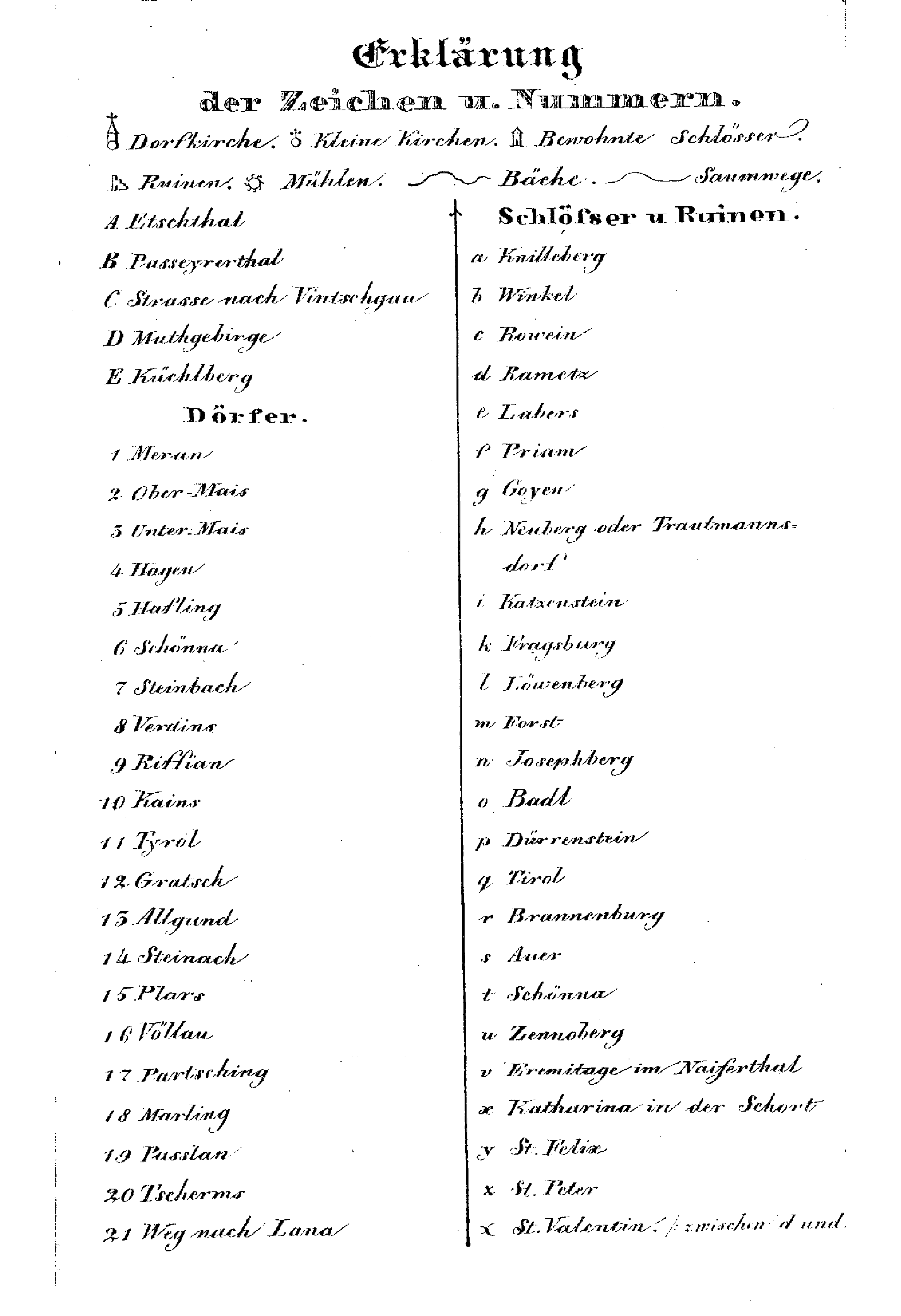

Legend to the map.
The image shows a historical legend to the map by Dr. Johann Nepomuk Huber, of the environs of Meran and the Burggrafenamt.
1830s5 tags

Zeitungsreise: Living History
2 articles
The image shows a historical legend to the map by Dr. Johann Nepomuk Huber, of the environs of Meran and the Burggrafenamt.
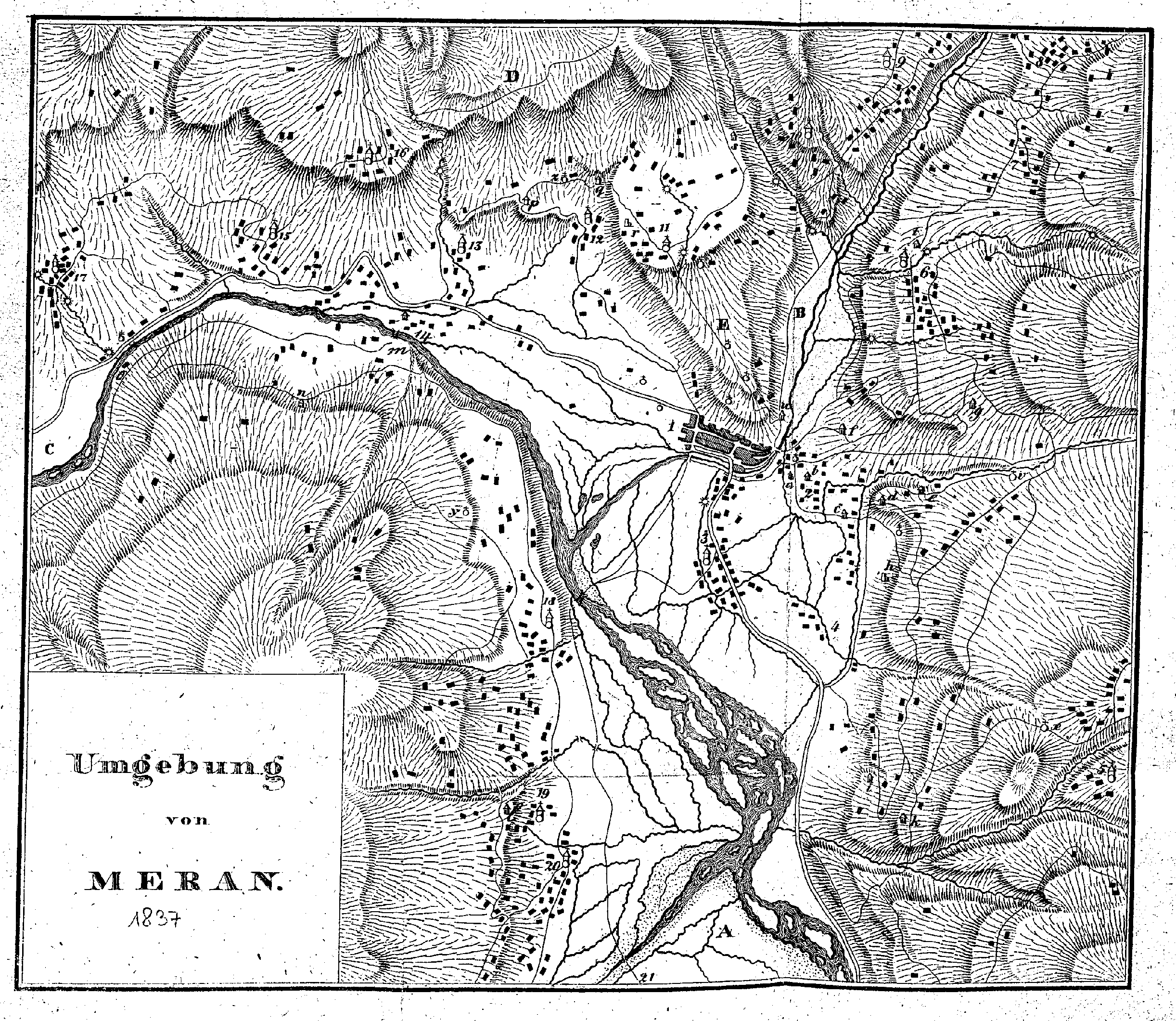
This historical map by Dr. Johann Nepomuk Huber shows the surroundings of Merano in the year 1837. Recorded in detail on the map are the topographical features of the Burggrafenamt, the course of the rivers (Passer/Etsch), as well as surrounding localities and farmsteads, marked with letters (A, B, C, D, E) and numbers. See > Explanation of signs and numbers
End of the archive reached.